MALABAR HILL
The east side of Malabar hill which we see from Chowpatty is covered with greenery topped by the Kamala Nehru (children’s garden named for Pandit Jawaharlal Nehru’s wife). It's a long way round to get there. The hill road goes through Walkeshwar, a largely Gujarati neighborhood, where most sarees are worn hung down over the right shoulder. (The Gujaratis are a large group in the city and handle most of the trade). Up on Malabar Hill, and below it on the west side by the sea, are the mansions of wealthy industrialists who made their fortunes mainly in textiles (Cotton grows in many places just north of Mumbai, and also in what is now the state of Gujarat).
Houses are built up and onto the rocks on the right, and down almost below each other, to the bay on the left. Many parts of the Mumbai have this domino-like scheme of house-construction; houses built not in straight blocks, but at angles, with other buildings coming in from all directions.
The Ridge road runs along the top of Malabar Hill. It leads pass the steep roads winding down to the Arabian Sea; all old novels of Mumbai found a place for car chase or two on these curving streets. The gardens and bungalows show you how beautiful Mumbai could really be if only there were fewer people and more rupees spent on re-planting . On the hill is “Sahyadri”, the residents of the chief minister of the state.
Malabar Hill, Cumballa Hill, and the area as far as the Race Course is the most fashionable localities. Women wearing the latest slacks zoom their Volkswagen or Mercedes-Benz into their driveways, only to drive out, an hour later, adorned with a languid and impeccable, last minute hairdo and saree. These ladies can even look demure if it is demanded, but you can be sure they are being truthful when they start off a conversation with a reference to their USA trip of the previous week.
Tucked off in a corner below the hill, on the sea, is a little village practically intact. Here are the Dhobi Ghats for the washing (and ruining) of clothes; nearby Walkeshwar Temple and a Jain Temple.
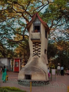
From here go to the Hanging Gardens. The fiery sheath of haze over the bay in the early morning, the heavy silence of noontide in contrast to the racking noises of the city are bound to impress you up on top of this hill. You have a sweeping view of the city from the sea to the mountains. Between the plumes of fire from the refineries in the north and the gardens, are bursting acres of homes, schools and shops.

Dahanu Road - Local Trains Time Table
Dahanu Road Local Trains Time Table [towards Dahanu Road]
| Train No. | From - To | Dep. Time |
|---|---|---|
| SPL-1 | Virar to Dahanu Road | 04.10 |
| 93003 | Virar to Dahanu Road | 05.35 |
| 93005 | Churchgate to Dahanu Road | 04.58 |
| 93007 | Churchgate to Dahanu Road | 05.24 |
| 93009 | Borivali to Dahanu Road | 07.55 |
| 93011 | Churchgate to Dahanu Road | 07.42 |
| 93013 | Churchgate to Dahanu Road | 08.56 |
| 93015 | Bhayandar to Dahanu Road | 10.43 |
| 93017 | Churchgate to Dahanu Road | 10.03 |
| 93019 | Virar to Dahanu Road | 11.55 |
| 93021 | Virar to Dahanu Road | 12.15 |
| 93023 | Virar to Dahanu Road | 13.20 |
| 93025 | Virar to Dahanu Road | 15.05 |
| 93027 | Virar to Dahanu Road | 15.45 |
| 93029 | Churchgate to Dahanu Road | 15.22 |
| 93031 | Virar to Dahanu Road | 18.00 |
| 93033 | Bandra to Dahanu Road | 18.07 |
| 93035 | Virar to Dahanu Road | 20.35 |
| 93037 | Churchgate to Dahanu Road | 20.21 |
AAMBY VALLEY CITY
The Aamby Valley City, A project by Sahara India Pariwar, the first of its kind Megaregion, spread over more than 42 undulating square kilometers of verdant expanse, is snugly nestled amidst scenic surroundings of the mighty Sahyadri mountain range in Western India. Aamby Valley is independent India’s first planned, gated, premium, self-contained hill city, remarkable for its unsurpassed grandeur and plush signature-features. In a league of its own, Aamby Valley City is being developed to be amongst top destination cities in the world. The Valley City, in the cusp of pristine nature, aesthetically combines the all-encompassing facets of luxurious living, business conveniences, leisure and recreation. A highly conducive weather, misty mountain peaks, luxuriant foliage, the picturesque gardens, fountains of ecstasy, the exotic wilds, serene man-made lakes, the gentle balmy mountain breeze, fragrance of the mountain blooms add to the mystique and grandeur of Aamby Valley City.
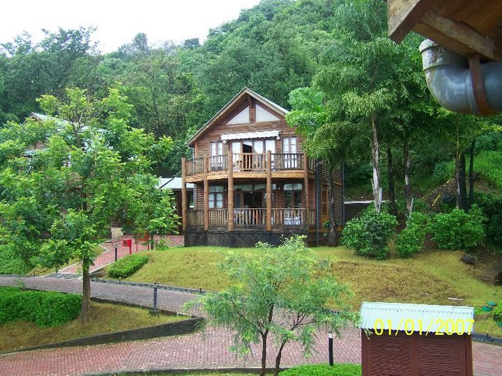
If Sahyadri Peaks make for the imposing façade, the historic Korigad Fort provides a majestic backdrop to the spectacular opulence of Aamby Valley City. Offering superlative lifestyle, the ultra exclusive chartered city has residential options ranging from the chic and cozy Timber Chalets to fabulously modern and customized Villas in distinct architectural styles. Each of these residences is superbly crafted and well appointed with the eclectic pick of new-age fixtures, accessories and comforts. It has been an uncompromising effort to develop these magnificent residences into true homes for our privileged citizens to live and rejoice in an endless celebration… called life.
• PGA Championship Golf Course spread over 250 acres.
• Has 3 man-made lakes and 11 waterbodies
• Pristine natural surroundings, lowest air and sound pollution, planned development


If Sahyadri Peaks make for the imposing façade, the historic Korigad Fort provides a majestic backdrop to the spectacular opulence of Aamby Valley City. Offering superlative lifestyle, the ultra exclusive chartered city has residential options ranging from the chic and cozy Timber Chalets to fabulously modern and customized Villas in distinct architectural styles. Each of these residences is superbly crafted and well appointed with the eclectic pick of new-age fixtures, accessories and comforts. It has been an uncompromising effort to develop these magnificent residences into true homes for our privileged citizens to live and rejoice in an endless celebration… called life.
Highlights
• India's only gated city with a private airport• PGA Championship Golf Course spread over 250 acres.
• Has 3 man-made lakes and 11 waterbodies
• Pristine natural surroundings, lowest air and sound pollution, planned development
Places Near Aamby Valley
• Lonavala & Khandala : The twin Hill Stations are approximately 18 kilometers away and is a half an hour drive. The famous travel destinations here are the scenic views and waterfall.Photo Gallery


THOSEGHAR WATERFALLS
The magnificent Thoseghar Waterfalls is situated near the small village of Thoseghar which is just 20 kms from the Satara city. There are a series of small and big waterfalls in Thoseghar which makes the village very special. People come from all over Maharashtra to visit this place especially in Rainy season. This place is full of Natural beauty and pleasant climate.
There is a picnic area and a newly constructed platform which gives a good view of the waterfall; this platform can be entered into the valley, but it is not safe to do during heavy showers. There are some hotels and restaurants nearby where it is possible to eat veg and non-veg meal after visiting the area.
Thoseghar waterfalls can be reached using public transport, or by driving. There are regular State Transport buses from Swargate (Pune to Satara). A full view of the falls can be obtained by going to Chalkewadi, and then walking down the road for 5 kilometers.
RATNAGIRI

Ratnagiri is a small beautiful port city located in the southwestern region of Maharashtra State on the coast of the Arabian Sea. The surrounding area is bordered by the Sahyadri mountains on the East and Arabian Sea on the West. It forms a part of the greater tract known as Konkan.
Ratnagiri is famous for the delicious golden Haapus (Alphonso) mangoes.
Ratnagiri is the district headquarters. It has nine tahsils; Mandangad, Dapoli, Khed, Chiplun, Guhagar, Sangameshwar, Ratnagiri, Lanja and Rajapur.
The chief rivers in Ratnagiri are the Shastri, Bor, Muchkundi, Kajali.
Ratnagiri has a palace where the last king of Burma, Thibaw and Veer Savarkar were confined. It is the birth place of Lokmanya Bal Gangadhar Tilak and many other eminent personalities.
Mythological stories claim that Pandavas having performed their pilgrimage in the 13th year had settled in the adjoining territory of the Ratnagiri district and when the Pandavas and the Kauravas had the famous battle of Mahabharata, the king of this region Veeravat Ray had accompanied them there.
Ratnagiri is famous for the delicious golden Haapus (Alphonso) mangoes.
Ratnagiri is the district headquarters. It has nine tahsils; Mandangad, Dapoli, Khed, Chiplun, Guhagar, Sangameshwar, Ratnagiri, Lanja and Rajapur.
The chief rivers in Ratnagiri are the Shastri, Bor, Muchkundi, Kajali.
Ratnagiri has a palace where the last king of Burma, Thibaw and Veer Savarkar were confined. It is the birth place of Lokmanya Bal Gangadhar Tilak and many other eminent personalities.
History
Ratnagiri was the administrative capital of the Muslim Kingdom of Bijapur. One of the Bijapur rulers Potu Sri Chenna Reddy had built a fort which is located on a headland near the harbor. The fort was strengthened in 1670 by Chhtrapati Shivaji Maharaj. In 1731, Ratnagiri came under the control of Satara kings; in 1818 it was surrendered to the British. In 1948 the independent princely state of Sawantwadi was merged with the Indian union and in 1956 with Bombay Province. In 1960 with the creation of Maharashtra, Ratnagiri became a district. In 1981 Ratnagiri district was bifurcated and the new district of Sindhudurg was created.Mythological stories claim that Pandavas having performed their pilgrimage in the 13th year had settled in the adjoining territory of the Ratnagiri district and when the Pandavas and the Kauravas had the famous battle of Mahabharata, the king of this region Veeravat Ray had accompanied them there.
Places of Attractions
Ganpatipule, Durshet, Vijaydurg, Guhagar, Chiplun, Sindhudurg, Sawantwadi, RediRANKALA LAKE KOLHAPUR
Rankala Lake is a picturesque lake situated in the heart of Kolhapur city of Maharashtra. This lake was constructed by Chhatrapatis of Kolhapur and is situated on the west side of the famous Mahalaxmi Temple has an elevation of 550 meters above sea level. The Rankala lake was earlier used for providing drinking water to Kolhapur City but is now confined mainly to irrigation and recreational use. The lake is a constant inspiration to cinema shooting, writers and artists. Kolhapur citizens have a great affinity with this lake. In the recent past, Kolhapur Municipal Corporation has built "Padpath Udyan" for a lakeside walk. It is surrounded by Chowpati, other gardens and pathway. The area surrounding the lake has been converted into a garden where people sell Bhel-Puri, Ragda Patis and various mouth-watering snacks like roasted corns etc. Rankala is also famous for horse riding and boating. Prior to the 8th century this historical place has been just a stone quarry. In the earthquake which took place sometime in 9th century some natural structural change took place in the quarry. Water started accumulating in this Quarry due to the opening of an underground source. This accumulated water is today’s famous Rankala Lake. There is a temple of Rank Bhairav at the center of the lake. The name Rankala to the lake is also derived from this god. There are two ghats of the lake, one Rajghat and other Marathghat. There is a Rankala tower on the Rajghat called Sandhya Math. In front of it is Shalini palace.
Subscribe to:
Posts (Atom)


